

Author: ericmaas
LIDAR SCANNING · 360° PHOTOGRAPHY · DRONE SCANNING · 2D DRAFTING · 3D MODELING ·
-

Using LiDAR for Tree Safety and More
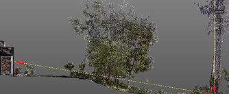
Read more: Using LiDAR for Tree Safety and MoreScanning landscapes yields surprising benefits beyond topo and tree locations: measure height and canopy, analyze volume and lean, and preview pruning before anyone climbs a ladder. Clients often want detailed topographic maps…
-

Recording the Past for the Future
Read more: Recording the Past for the FutureScanning, photographing and modeling provides remote access, records “doomed” buildings and can guide reproduction in the event of a catastrophic event. The devastating fire at Notre Dame de Paris highlighted the critical…
-
SFYC Piling Documentation
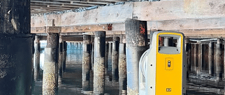
Read more: SFYC Piling DocumentationSalt Water, Rising Tides and Planning for Sea Level Change Founded in 1869, the San Francisco Yacht Club is the oldest club on the West Coast. Like all coastal facilities the club…
-

Existing Conditions vs. As-Builts
Read more: Existing Conditions vs. As-BuiltsExisting Conditions Captures “Before” and As-Builts Records “After” At the beginning, sometimes before a property is purchased, the buyer, agent, architect, or contractors will ask for “plans”. At first glance this seems…
-

What (the Heck) is BIM?
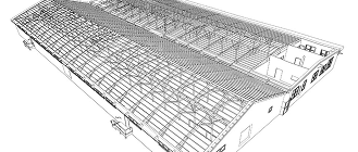
Read more: What (the Heck) is BIM?3D Models Take a Little More Time But Add A LOT of Value BIM, Building Information Modeling, is CAD,Computer Aided Design, on steroids. CAD models are the digital equivalent of old school…